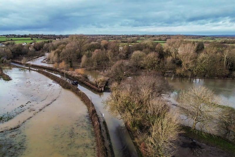
The images taken by Jason Reeve show flooded fields and roads at the East Sussex village.
The live map at AA Traffic News at www.theaa.com/route-planner/traffic-news currently shows that Barcombe Mill Road near the River Ouse is closed off. It has also reported that nearby Sharpsbridge Lane on the route Piltdown is closed because of flooding.
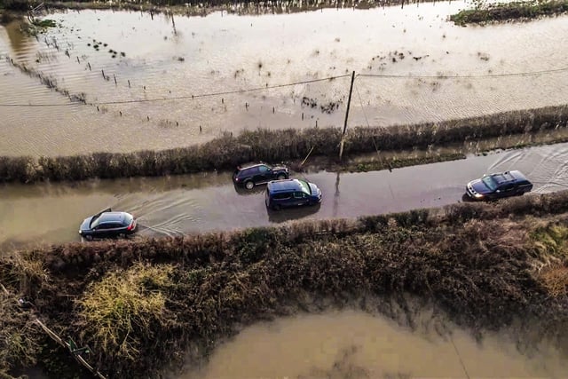
1. Barcombe flooding
Reader Jason Reeve has shared drone photos of flooding in Barcombe on Wednesday, January 3 Photo: Jason Reeve

2. Barcombe flooding
Reader Jason Reeve has shared drone photos of flooding in Barcombe on Wednesday, January 3 Photo: Jason Reeve
3. Barcombe flooding
Reader Jason Reeve has shared drone photos of flooding in Barcombe on Wednesday, January 3 Photo: Jason Reeve

4. Barcombe flooding
Reader Jason Reeve has shared drone photos of flooding in Barcombe on Wednesday, January Photo: Jason Reeve